

For broadcast quality video and images, visit the ICESat-2 SVS gallery.
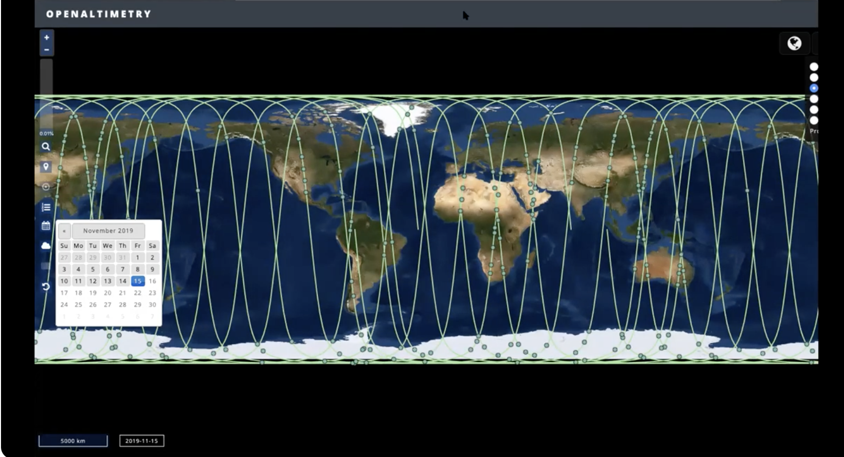
This video shows how students, teachers, and citizen scientists can take existing GLOBE Observer data for tree height and compare it to the tree canopy height data from the NASA Ice, Cloud, and land Elevation Satellite- or ICESat-2 Mission. The online Open Altimetry Tool allows you to look and see when ICESat-2 flew over or near the location of the tree you have the GLOBE data for already. It is a fun and simple thing to do and helps you become a part of a larger NASA mission.
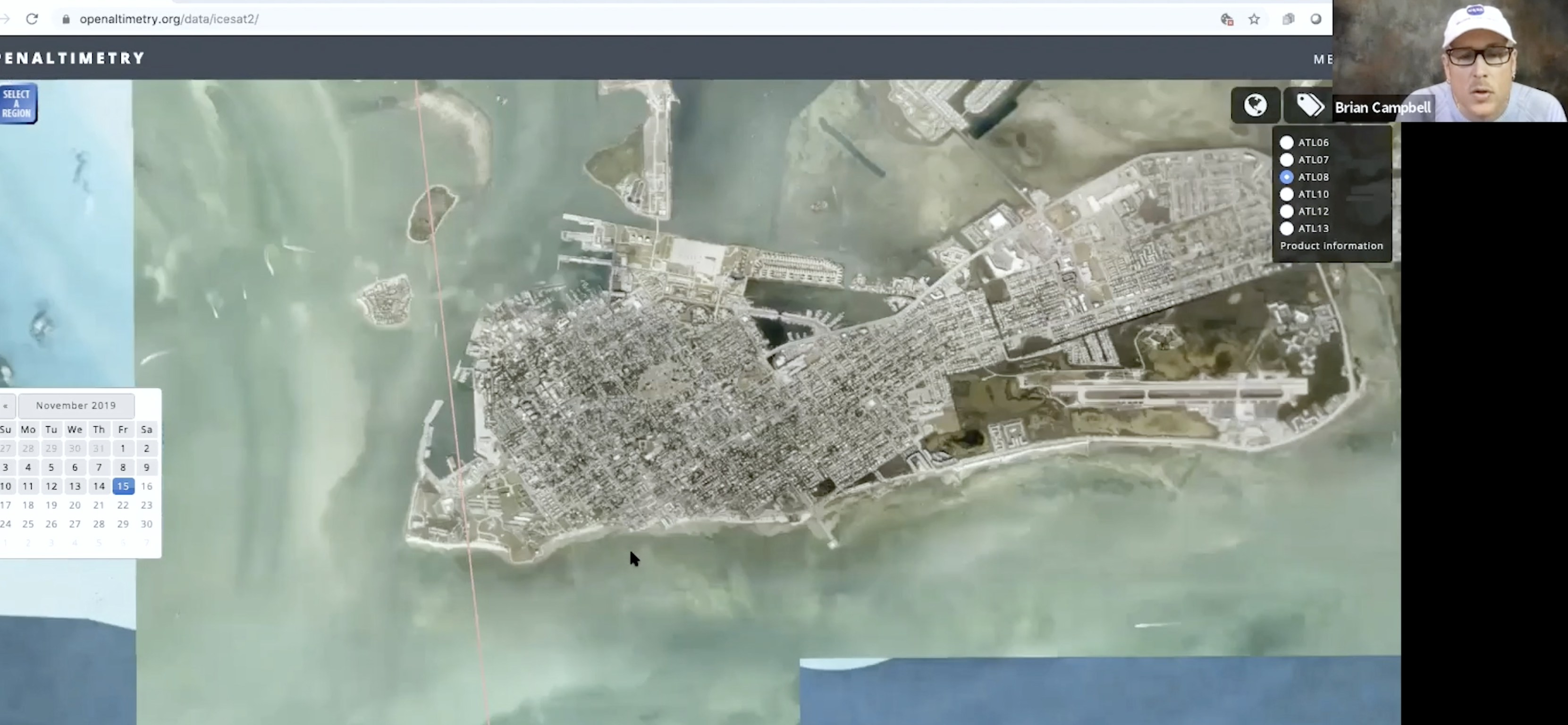
NASA's ICESat-2 uses lasers to measure heights on Earth, including tree heights. Join NASA Wallop's Brian Campbell, ICESat-2 Education Lead (and NASA GLOBE Observer Trees Science Lead) as he demos all about the satellite. Plus, learn how to look at the data coming from ICESat-2 on the Open Altimetry online tool.
We live, play and work with trees everywhere around the globe. The Trees Around the GLOBE Student Research Campaign commenced on September 15, 2018 in conjunction with NASA's ICESat-2 satellite launch on the same date at 6:02am PDT. The ICESat-2 satellite uses an on-board laser altimeter system to measure the height of Earth. Measurements of ice sheets, sea ice, trees, bodies of water, mountains are all part of what ICESat-2 measures. The Trees Around the GLOBE Student Research Campaign is a GLOBE Program campaign focusing on tree height - one of the measurements conducted by the ICESat-2 mission.
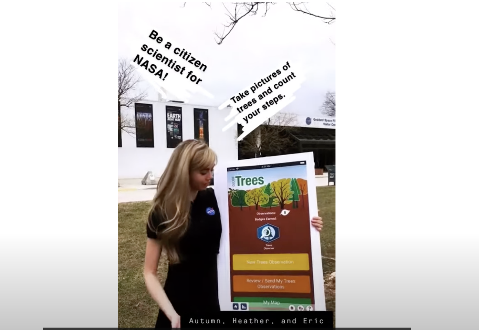
This is a video archive of the GLOBE Observer: Trees Snapchat story that went out on the NASA Snapchat account on March 26, 2019 as part of the release of the new Trees tool.
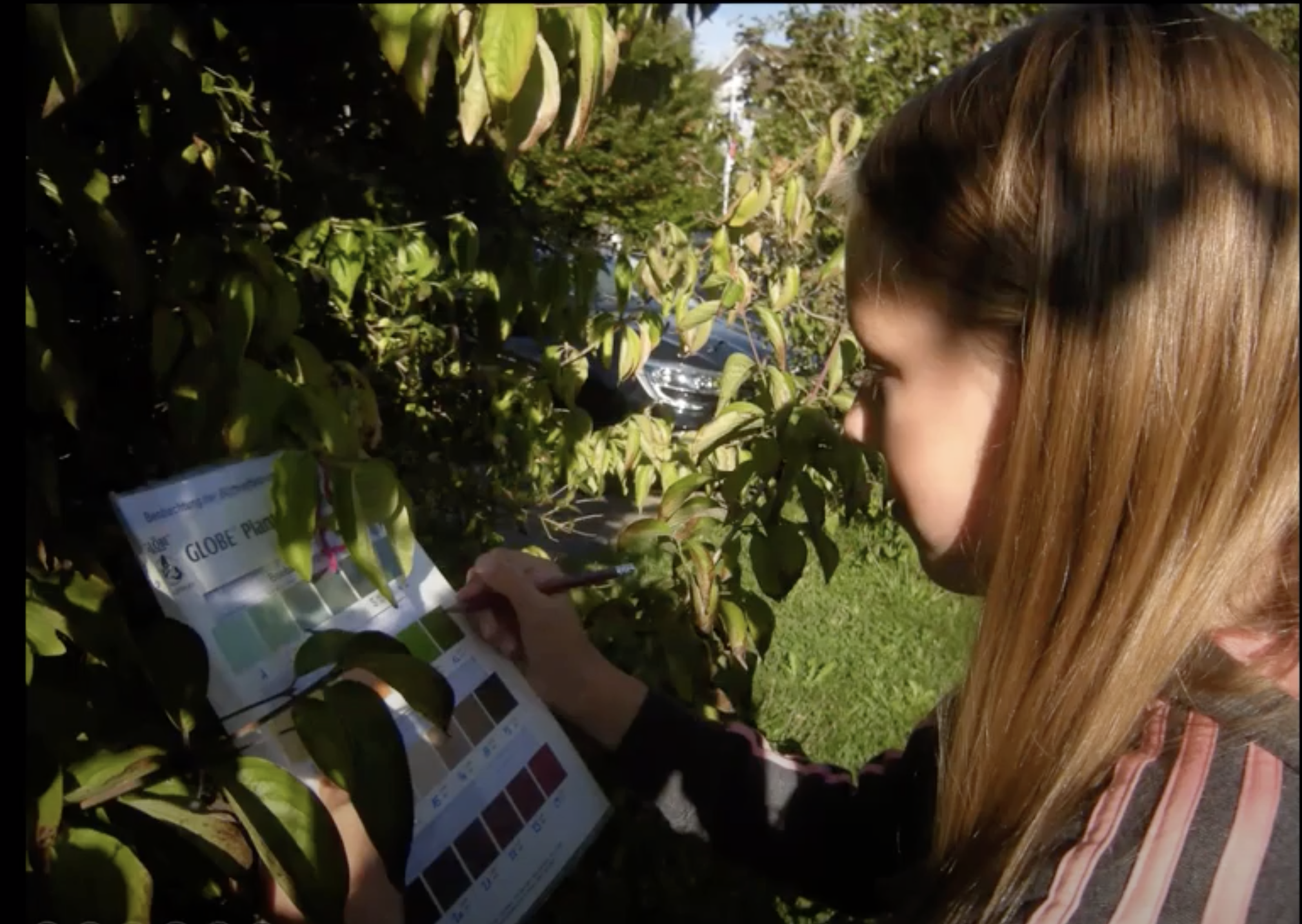
The Trees Tool in the NASA GLOBE Observer (NASA GO) app allows citizen scientist observers to use their mobile devices to take tree height and tree circumference measurements all over the globe.
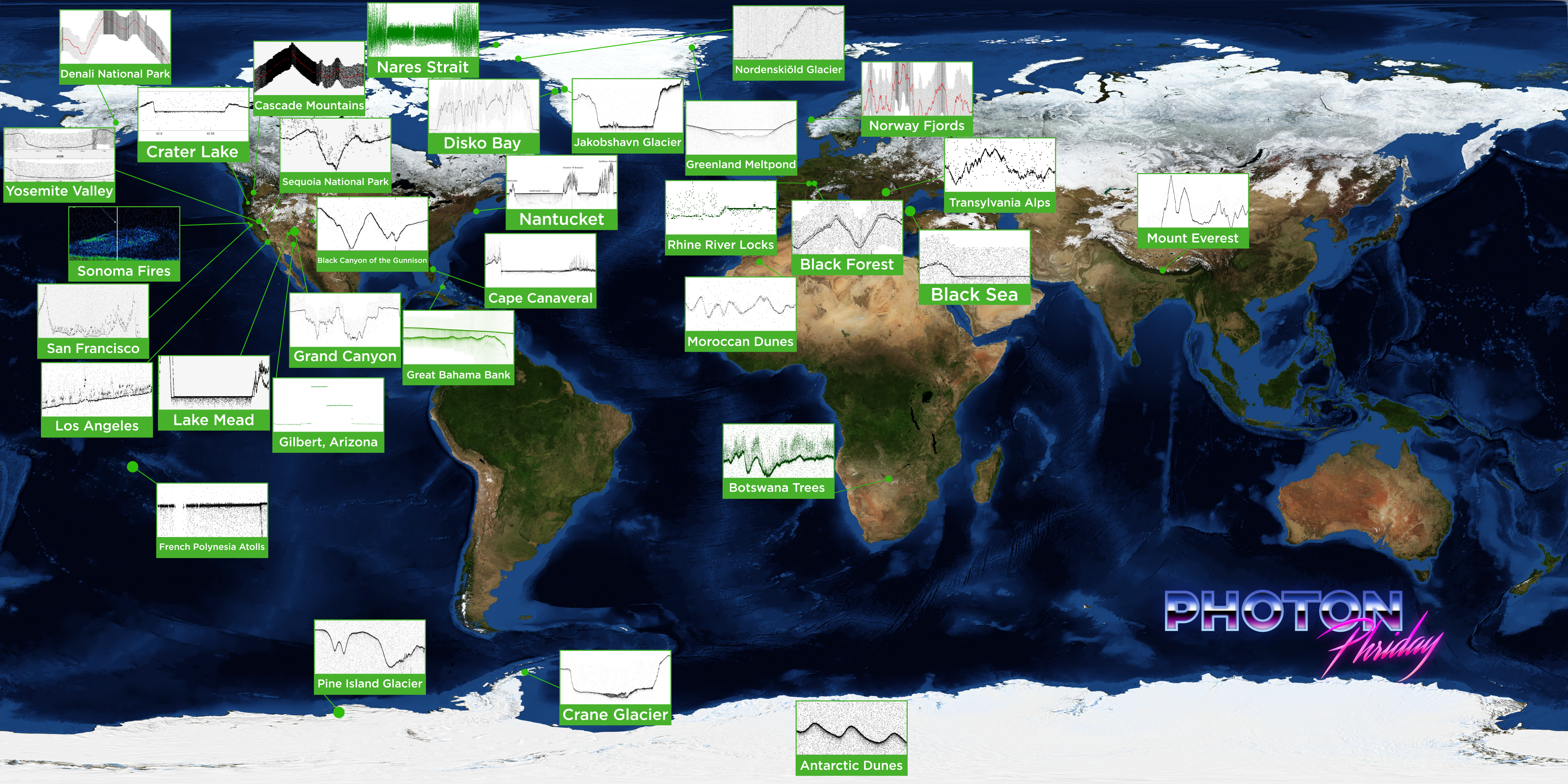
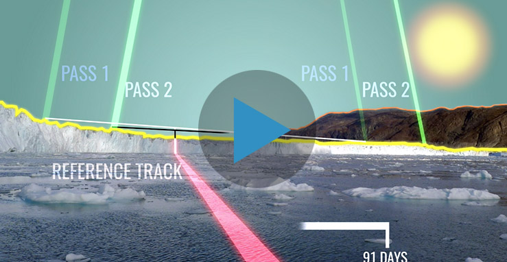
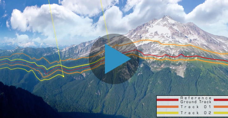
#PhotonPhriday looks at how ICESat-2 measures Earth – from Antarctic dunes to the Bahamas to Greenland’s glaciers.
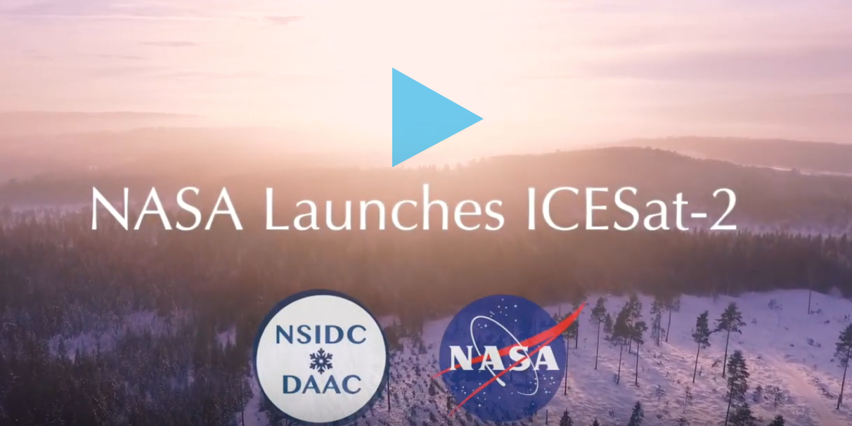
The National Snow and Ice Data Center (NSIDC) archives and distributes data from ICESat-2. Here is their intro video to the mission.
The Trees Around the GLOBE Student Research Campaign is a multi-year campaign for students and educators from around the world. This campaign highlights measurements of tree height and focuses on the scientific, cultural, and personal foundation of trees. Learn more about the campaign here.

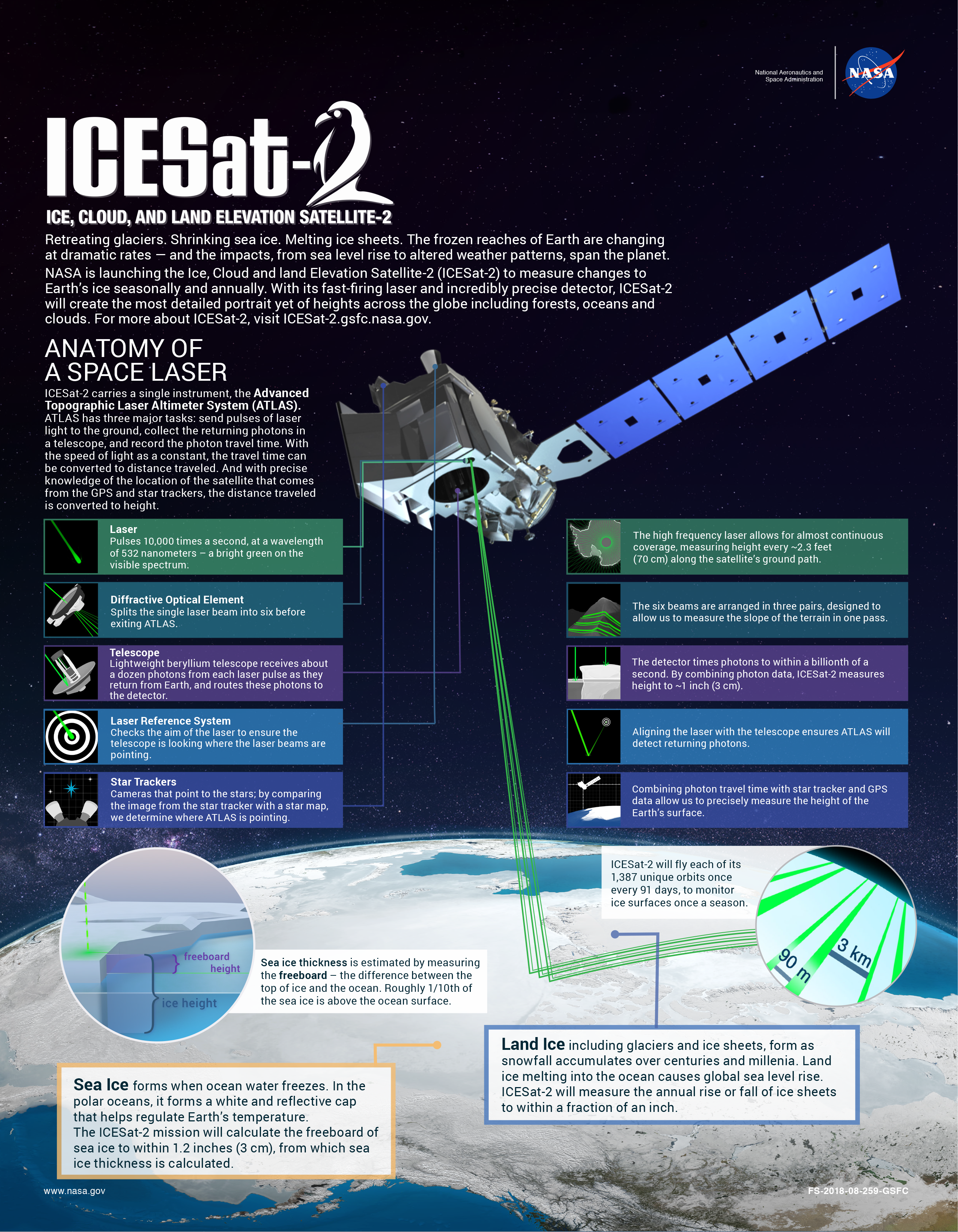
ICESat-2 is an incredibly precise space laser that features the latest in NASA technology To measure ice heights, engineers have to take ICESat-2’s instrument ATLAS to the extreme – sometimes going big, sometimes going small, but always keeping it precise.
Download high resolution video here.
Video Credit: NASA/GSFC

With extreme cold-weather gear, scientific instruments, and two tank-like snow machines called PistenBullys, ICESat-2 scientists traversed along section of the 88-degree south latitude line in an arc around the South Pole.
Download high resolution video here.
Video Credit: NASA/GSFC
ICESat-2 is an incredibly precise space laser that features the latest in NASA technology To measure ice heights, engineers have to take ICESat-2’s instrument ATLAS to the extreme – sometimes going big, sometimes going small, but always keeping it precise.
Download high resolution video here.
Video Credit: NASA/GSFC

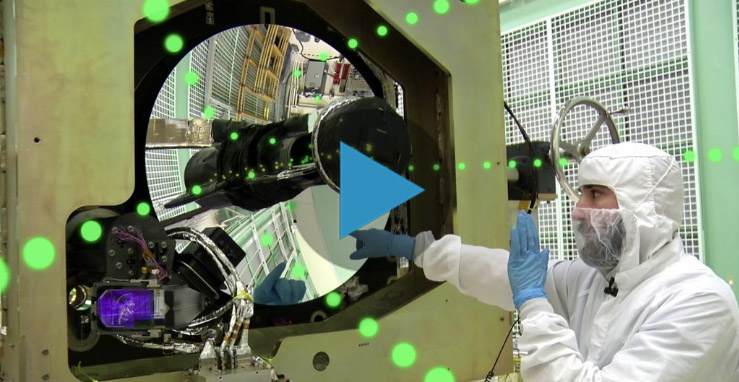
To deliver the instrument safely to the spacecraft for assembly and testing, the ATLAS team developed special procedures for packing, transporting and monitoring the sensitive hardware.
Download full resolution video here.
Video Credit: NASA/GSFC
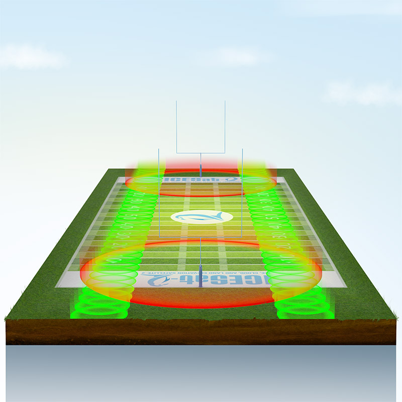
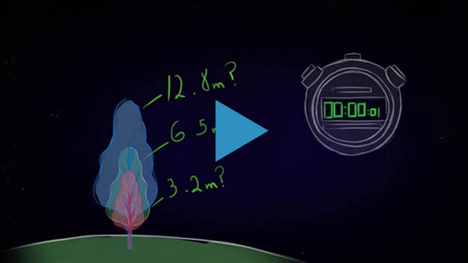
If ICESat-2 flew over a football field, it would take measurements within each yard line (green circles) – plus there's six of these green laser beams taking measurements at once! The first ICESat instrument only fired 40 times a second, and would have taken a measurement in each end zone (red circles).
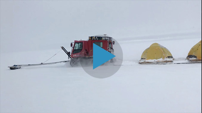
NASA cryospheric scientist Kelly Brunt and ICESat-2 Deputy Project Scientist Tom Neumann recall some of the highlights and challenges from the recent 88-South Antarctic Traverse.
Download high resolution video here.
Video Credit: NASA/GSFC
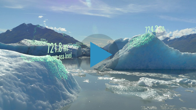
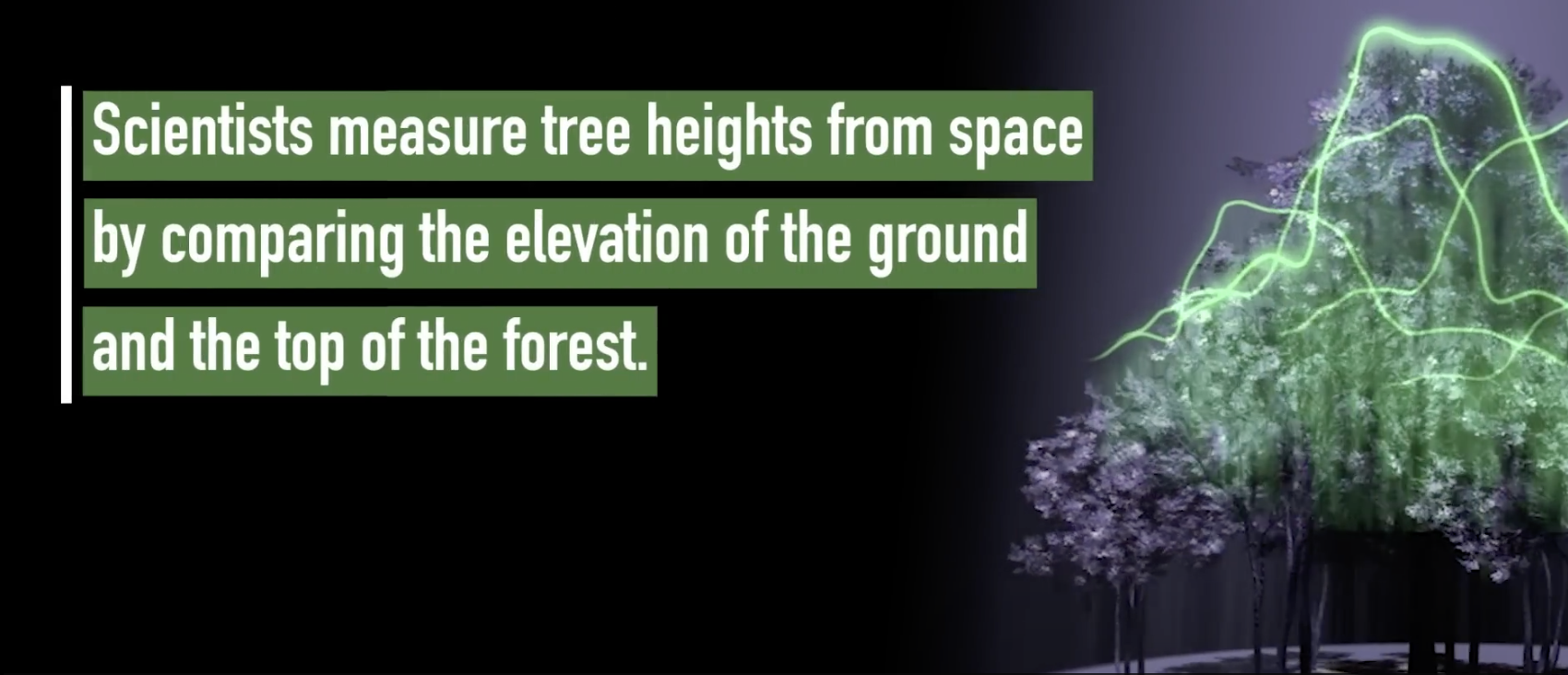
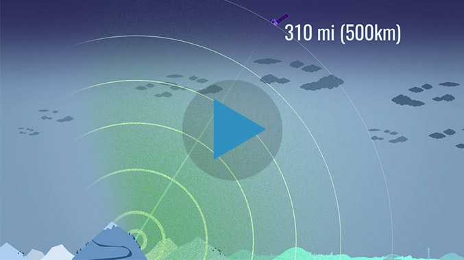
ICESat-2 provides scientists with height measurements that create a global portrait of Earth’s third dimension, gathering data that can precisely track changes of terrain including glaciers, sea ice, forests and more.
Download full resolution video here.
Video Credit: NASA/GSFC
ICESat-2 is an incredibly precise space laser that features the latest in NASA technology To measure ice heights, engineers have to take ICESat-2’s instrument ATLAS to the extreme – sometimes going big, sometimes going small, but always keeping it precise.
Download high resolution video about laser measurements here.
Video Credit: NASA/GSFC
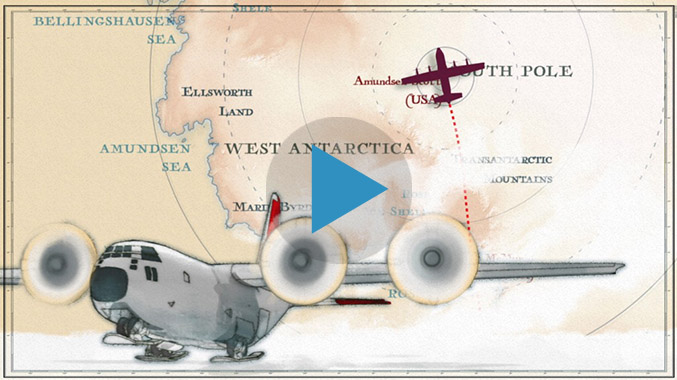
With extreme cold-weather gear, scientific instruments, and two tank-like snow machines called PistenBullys, ICESat-2 scientists traversed along section of the 88-degree south latitude line in an arc around the South Pole.
Download high resolution South Pole video here.
Video Credit: NASA/GSFC
Deputy Systems Engineer Phil Luers explains how the ATLAS transmitter and receiver subsystems come together to calculate the timing of photons, which, in turn, measure the elevation of ice.
Download high resolution video about laser timing here
Video Credits:
NASA/GSFC
Music: "Electric Works" by Philippe Lhommet, Koka Media; "From Source to Sea" by Christophe Lebled, Pierre Jacquot, Koka Media.
Laser Focus: The Receiver
Opto-Mechanical Engineer Tyler Evans explains how the photons that bounce back from Earth are received and filtered by the ATLAS telescope.
Download high resolution video about the receiver here.
Video Credit: NASA/GSFC
Opto-Mechanical Engineer Tyler Evans illustrates how the laser is transmitted from the ATLAS instrument on the ICESat-2 spacecraft.
Video Credit: NASA/GSFC
Download high resolution video about laser transmission here.
The ATLAS lidar on ICESat-2 uses 6 laser beams to measure the earth’s elevation and elevation change. This animation shows the beam tracks on Earth as the satellite passes overhead.
Download high resolution video about slope measurements here
Video Credit: NASA/GSFC