

For broadcast quality video and images, visit the ICESat-2 SVS gallery.

In Photon Jump, a 3-minute short animation, a brave photon of light named Pho must travel from a NASA spacecraft down to Earth and back again to help complete a crucial science mission. The animation was created by the ICESat-2/SCAD Collaborative Student Project involving students and faculty from the Savannah College of Art and Design.
Download high resolution Pho Trailer video here.
Video Credit: NASA/GSFC
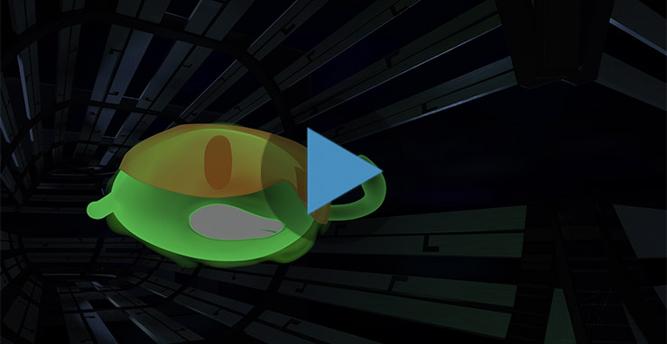
Pho, a plucky bright green photon of light, must travel from a NASA spacecraft down to Earth and back again to help complete a crucial science mission in this educational short film.
Download high resolution Photon Jump video here
Video Credit: NASA/GSFC and SCAD
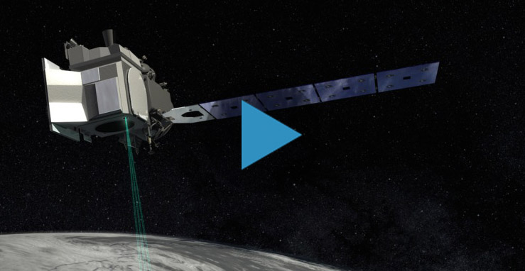
The Ice, Cloud and land Elevation Satellite-2, or ICESat-2, is a laser altimeter that will measure the heights of Earth’s surfaces. This animation shows deployment of ICESat-2's solar panels, door, and laser pulses.
You can download high resolution Deployment and Laser Pulses video here.
Video Credit: NASA/GSFC
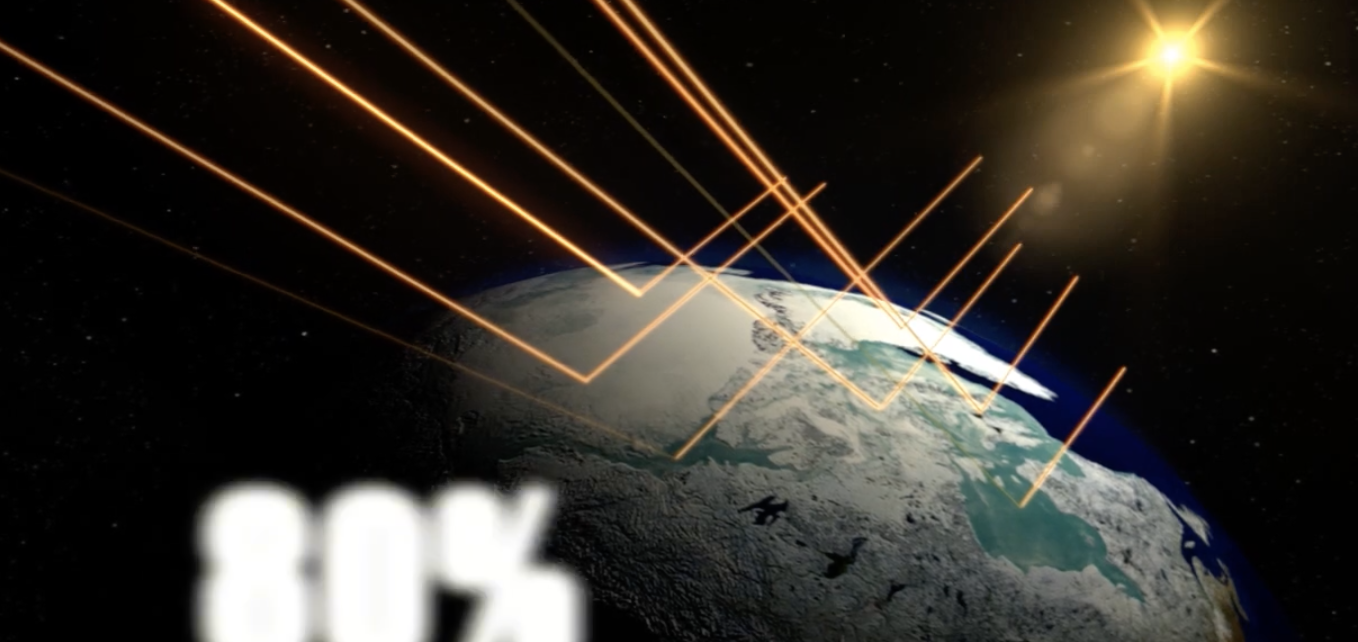
Learn how ICESat-2 will be used to map the ice structures in the world's polar regions, allowing scientists to study changes on Earth.
To learn more and to download the high definition video, click here.
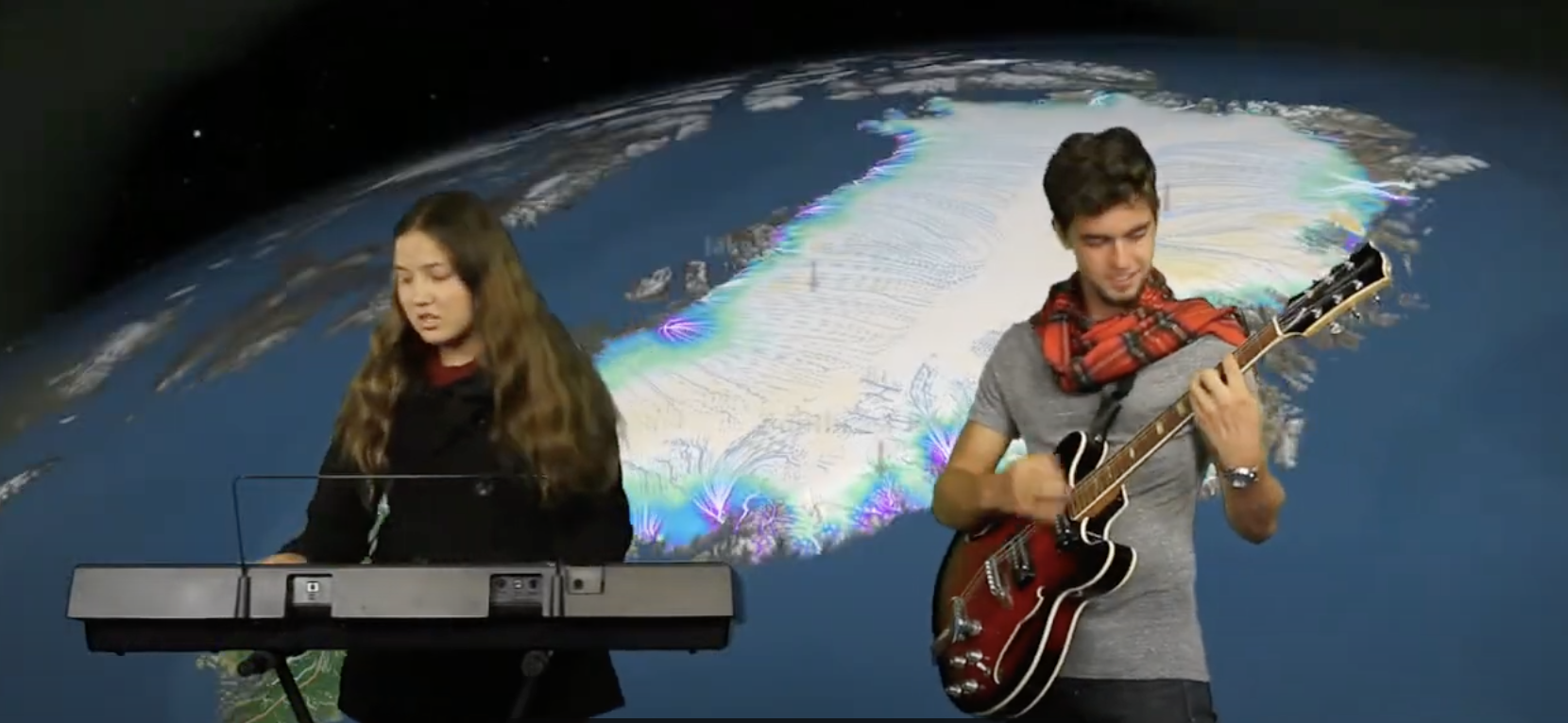
Watch the high school winners of NASA's Reel Science Communication Contest. Video and original music created and performed by Anna and Geof Olson.
ICESat-2 allows NASA's scientists to make accurate maps of polar ice sheets, which helps improve predictions about weather patterns, climate change, and the effects of changing ice structures.
Download the Classroom Viewing Guide
Click HERE to see more and to download the high definition video.

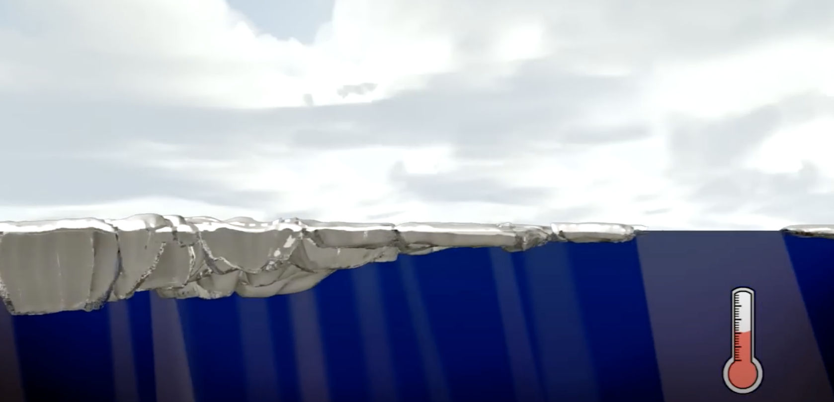
What is ice? NASA and ICESat-2 scientists explain the unique and essential qualities of frozen water. Water, unlike other types of matter, is less dense as a solid than as a liquid, allowing ice cubes -- as well as bigger chunks of ice -- to float on top of liquid water. Floating ice on lakes and oceans is important, allowing life to live in the water beneath it. Ice covered regions also have a big impact on our planet's climate and weather, even far away from the polar regions.
Download the Classroom Viewing Guide.
To see more and to download the high definition video click here
Earth's cryosphere includes all its frozen structures, such as sea ice, ice caps, and permafrost. Understanding changes in the cryosphere provides scientists with valuable information about the past, present, and future of the planet. ICESat-2 will help scientists learn more about Earth's ice.
View the Classroom Viewing Guide!
To see more and to download the high definition video, click here.

The ATLAS box structure, with weights attached to simulate different components, is attached to a vibration table at NASA's Goddard Space Flight Center in Greenbelt, Maryland, where it will be tested to see if it can withstand the jolts associated with a rocket launch.

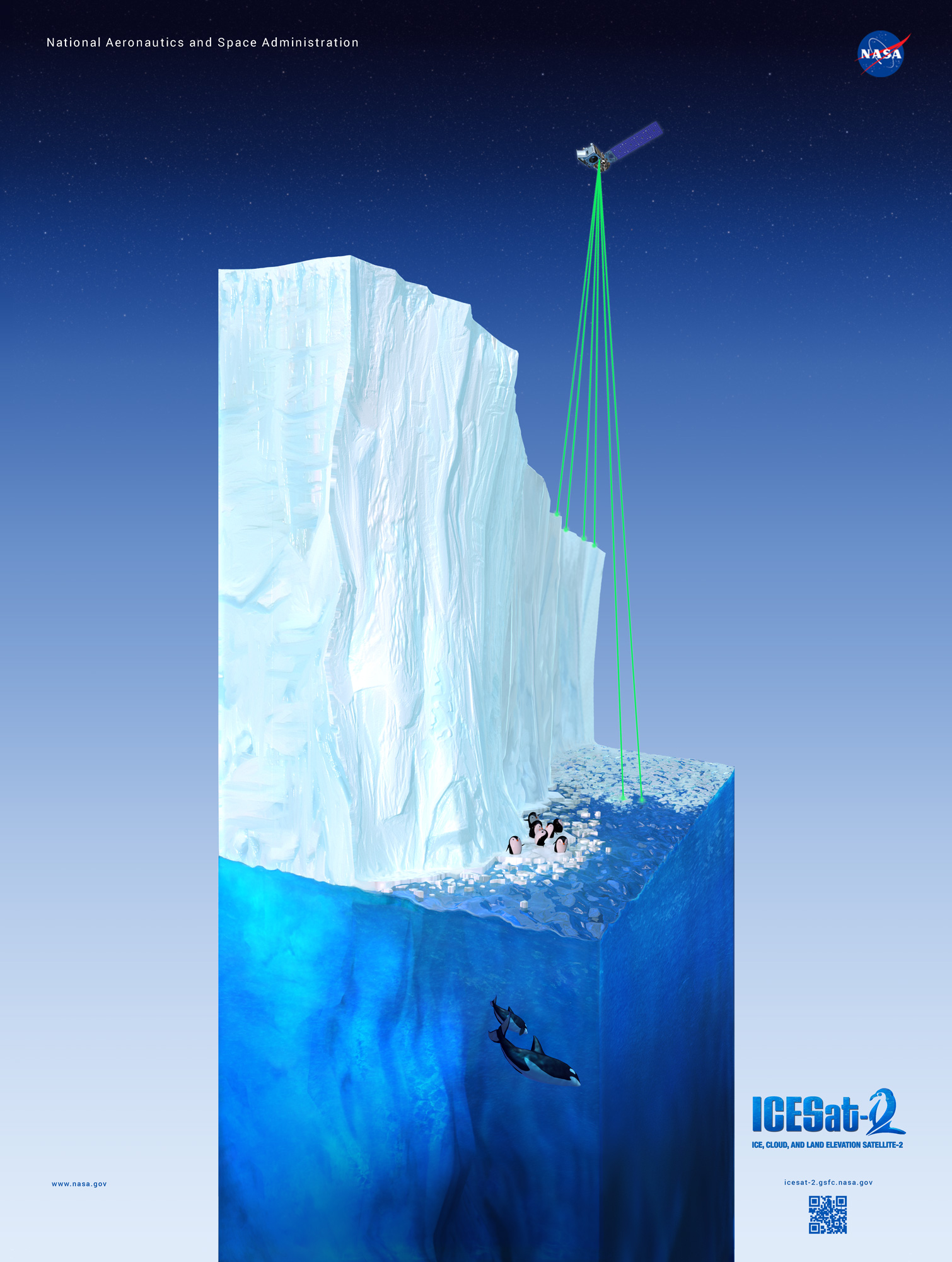
ICESat-2 will use six laser beams to measure the height of ice, as illustrated in this not-to-scale artist's rendering. This illustration is an outcome of the ICESat-2/SCAD Collaborative Student Project.
ICESat-2's instrument will take measurements every 2.5 feet along its ground path - mapping dips and drop-offs in the ice. This illustration is an outcome of the ICESat-2/SCAD Collaborative Student Project.
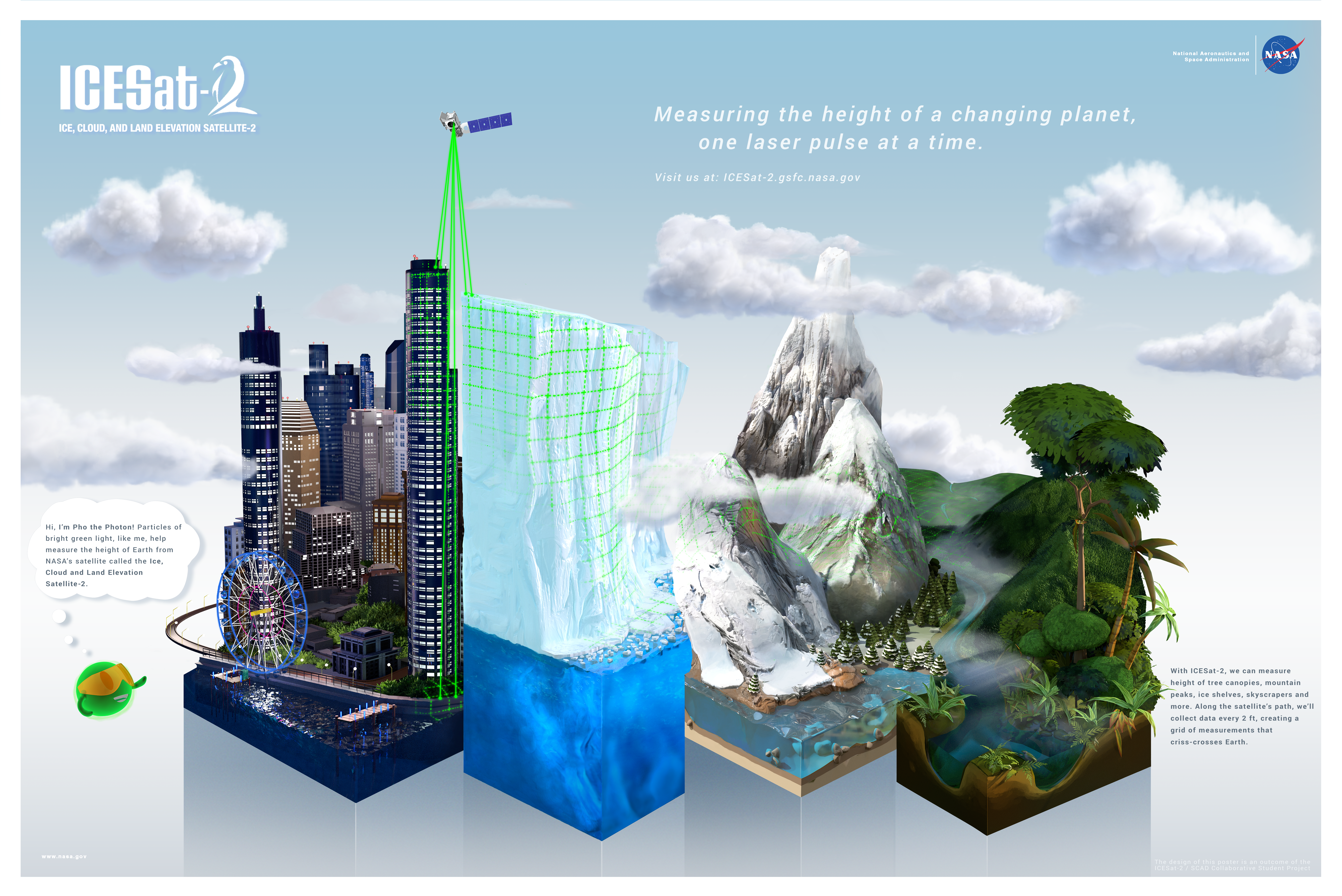
Beyond icy areas, ICESat-2 will measure other ecosystems including forests, rain forests, deserts and urban areas. This 2-sided poster is an outcome of the ICESat-2/SCAD Collaborative Student Project.
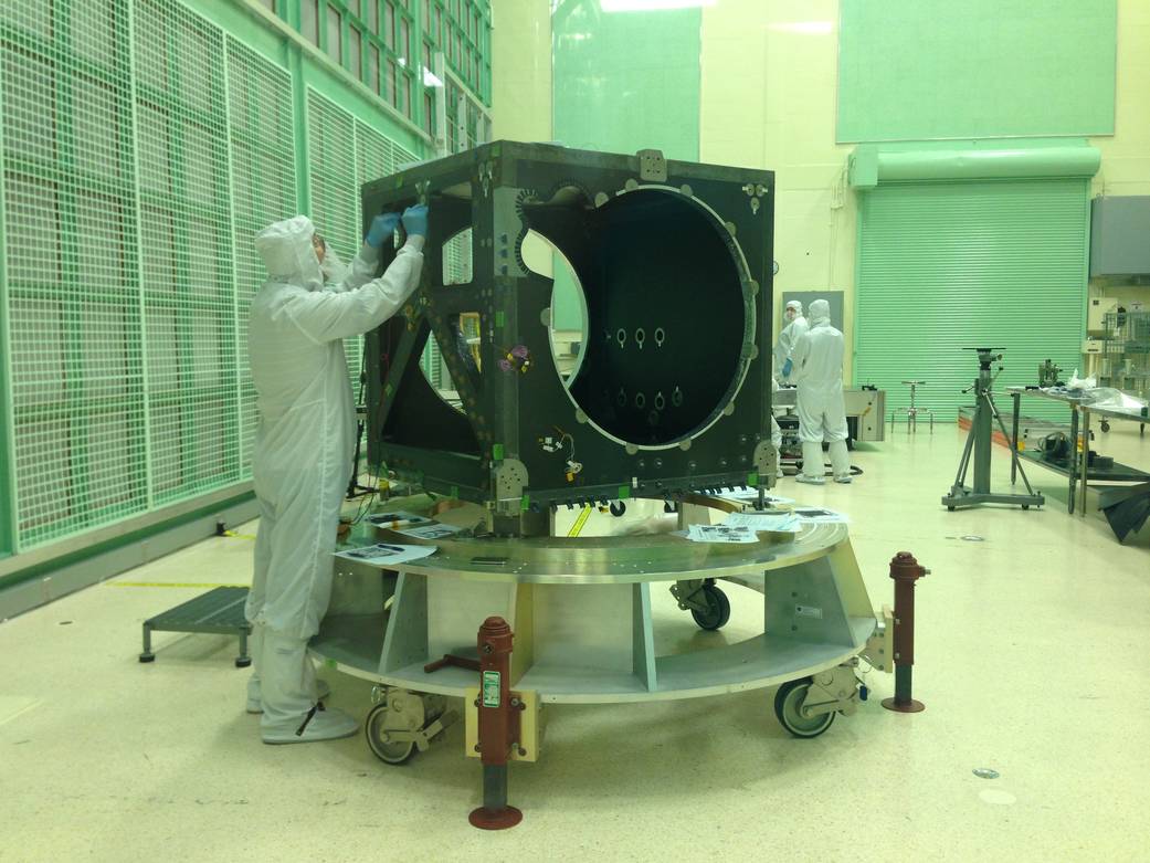
An engineer checks ICESat-2's box structure, shortly after its arrival in a NASA clean room in May. Over the next two years, engineers and technicians will attach electronics, optics, lasers, a telescope and more to the box, testing its function at each step.
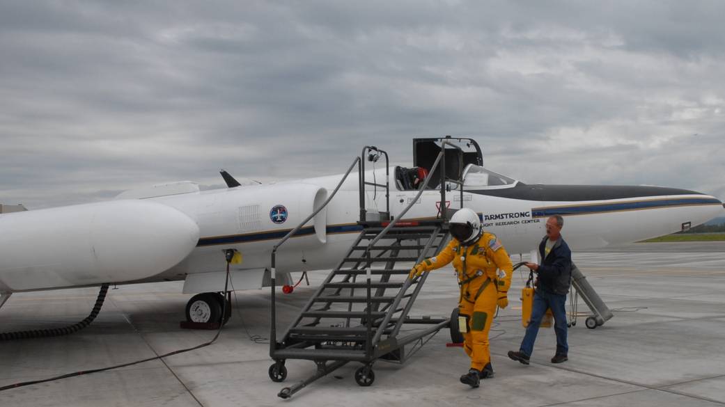
To develop the computer programs that will crunch the raw data gathered by ICESat-2, the mission flew a series of campaigns with the MABEL instrument, which gathers similar information.
Engineers are building and testing the Advanced Topographic Laser Altimeter System (ATLAS) for the ICESat-2 mission at NASA's Goddard Space Flight Center in Greenbelt, Maryland.
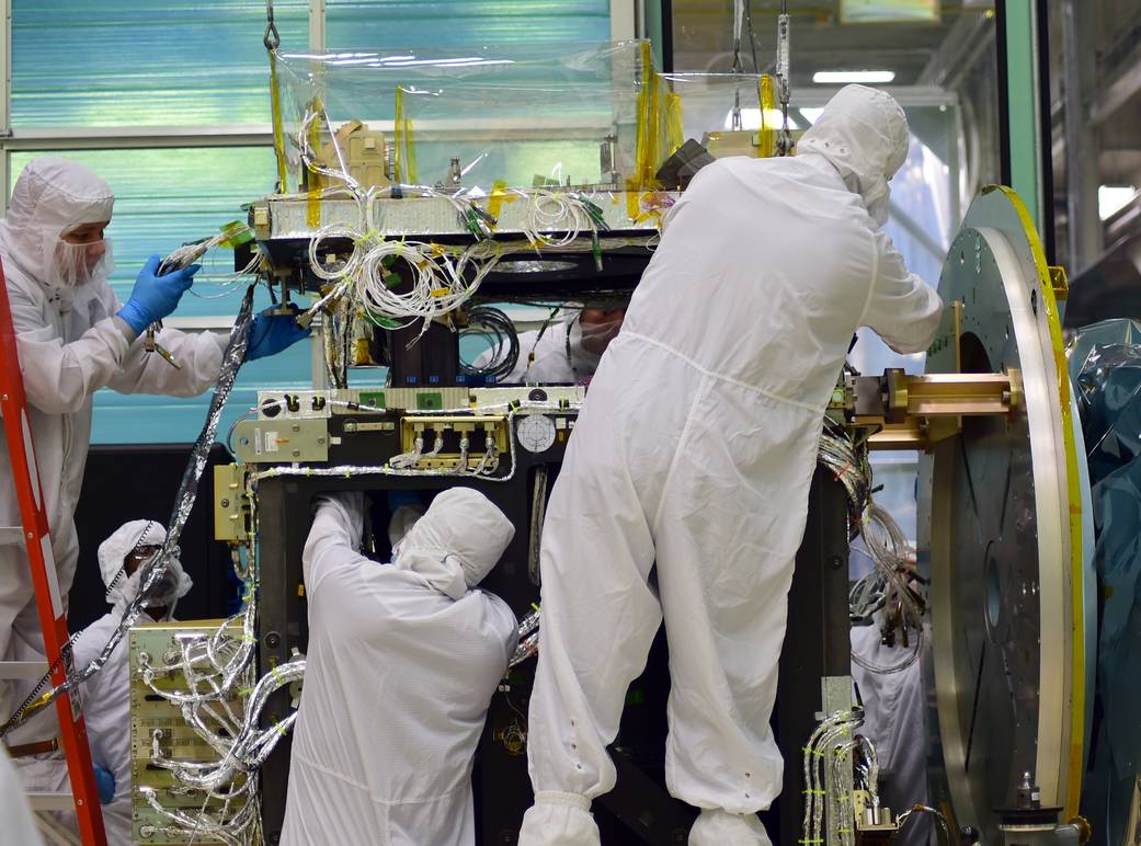
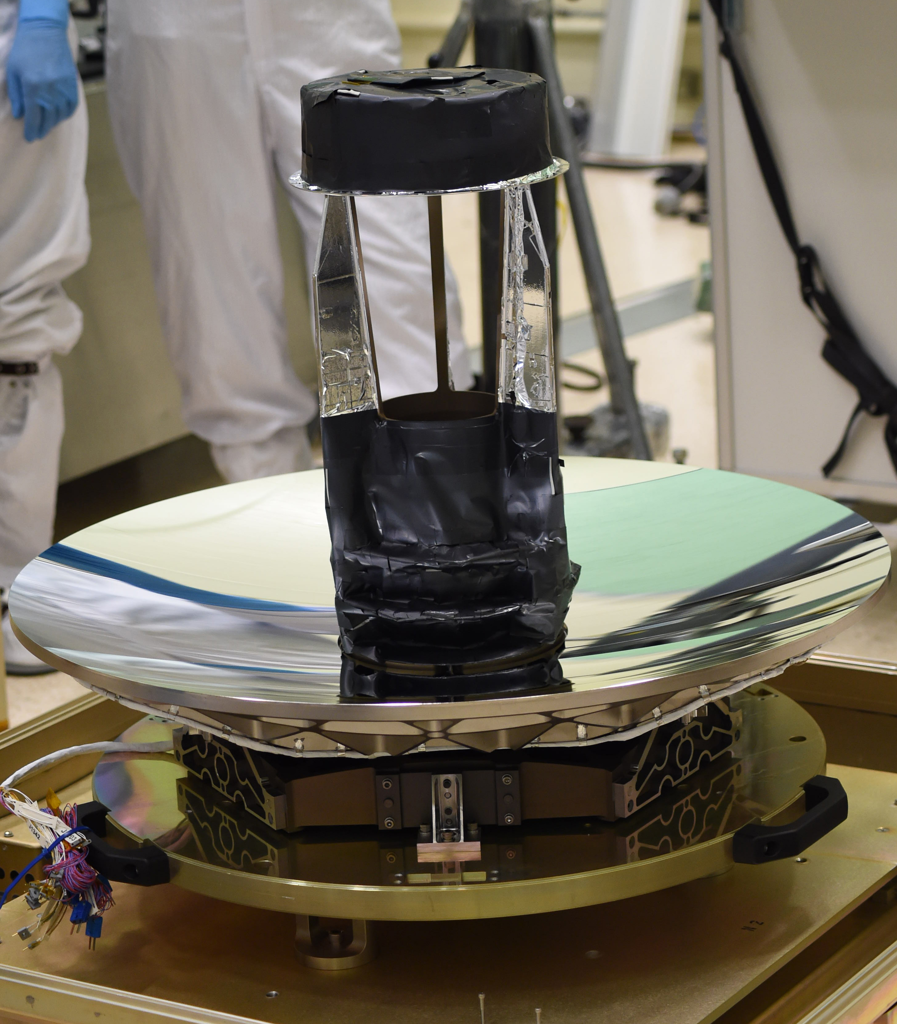
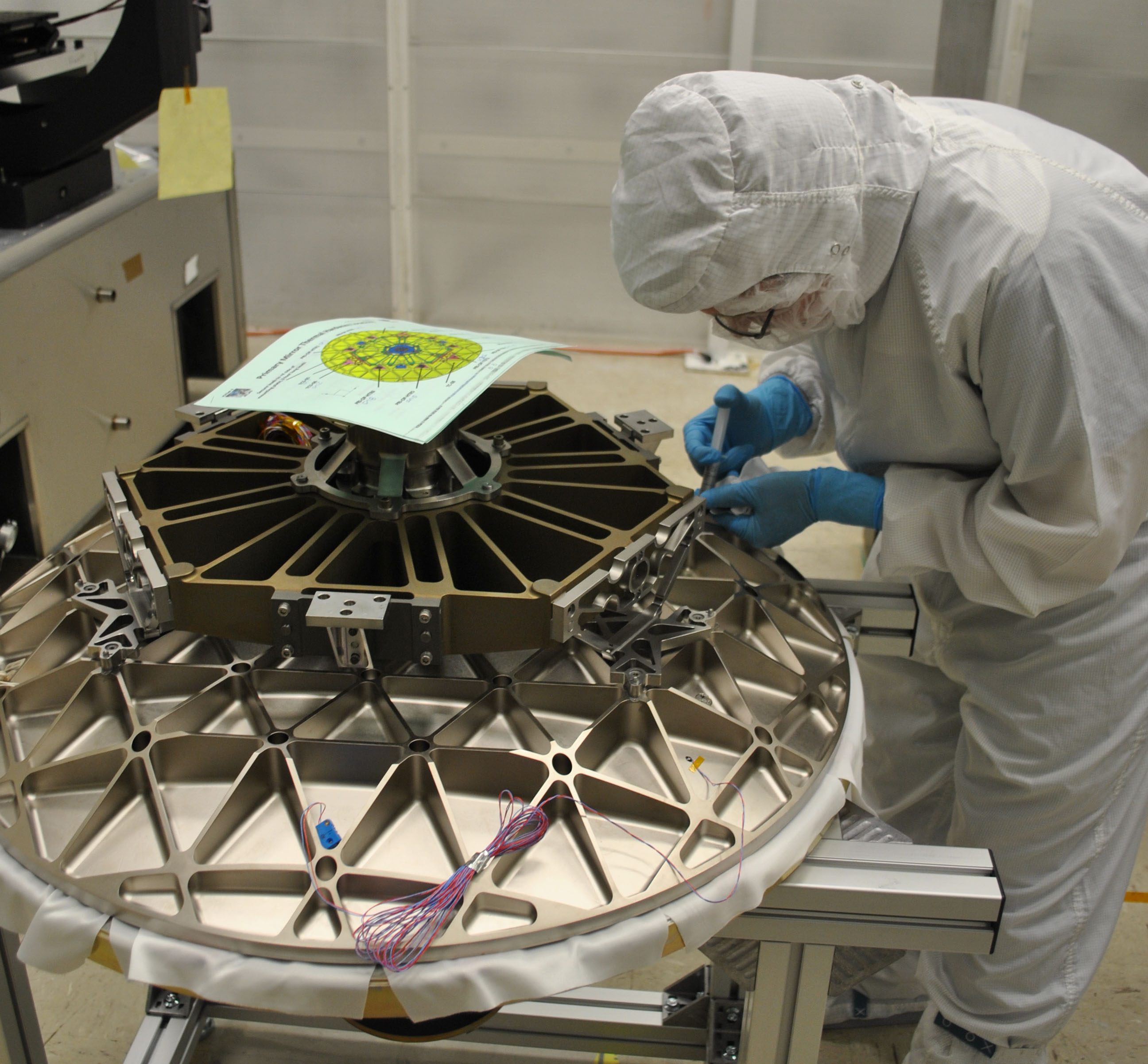
Engineers and technicians check the fit of ICESat-2’s telescope to its sling, before moving it into place on the instrument’s optical bench.
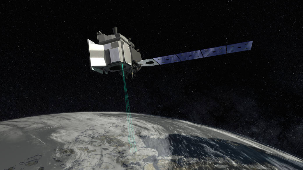
In this artist's concept of ICESat-2, the satellite's laser beams are visible as it orbits.
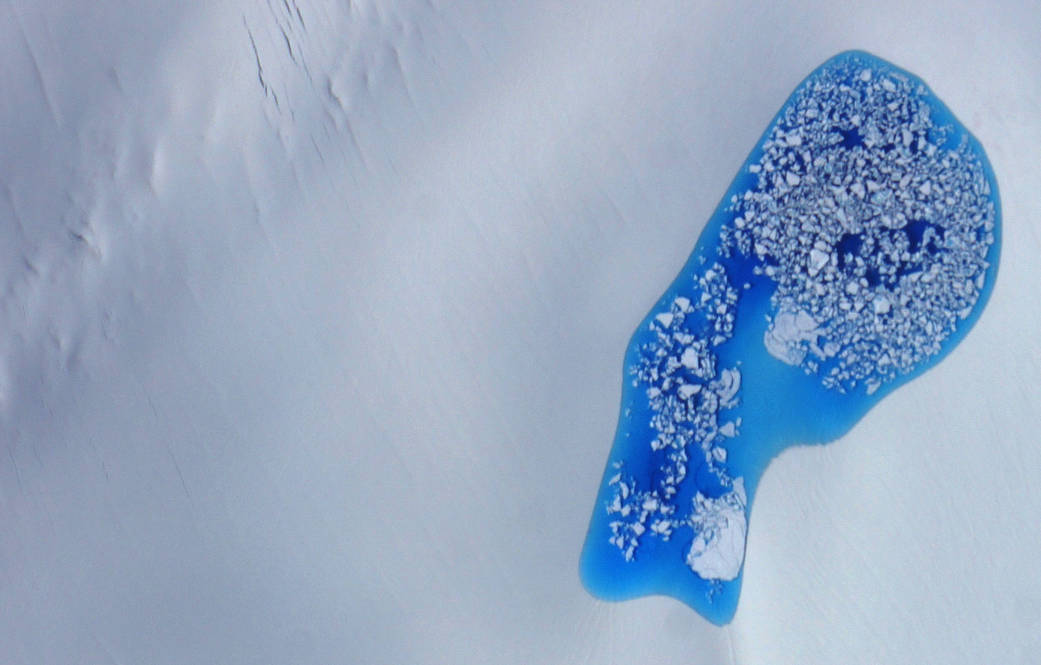
ICESat-2 measures the height of ice and its features, such as this glacial melt pond photographed July 16, 2014, over Alaska.
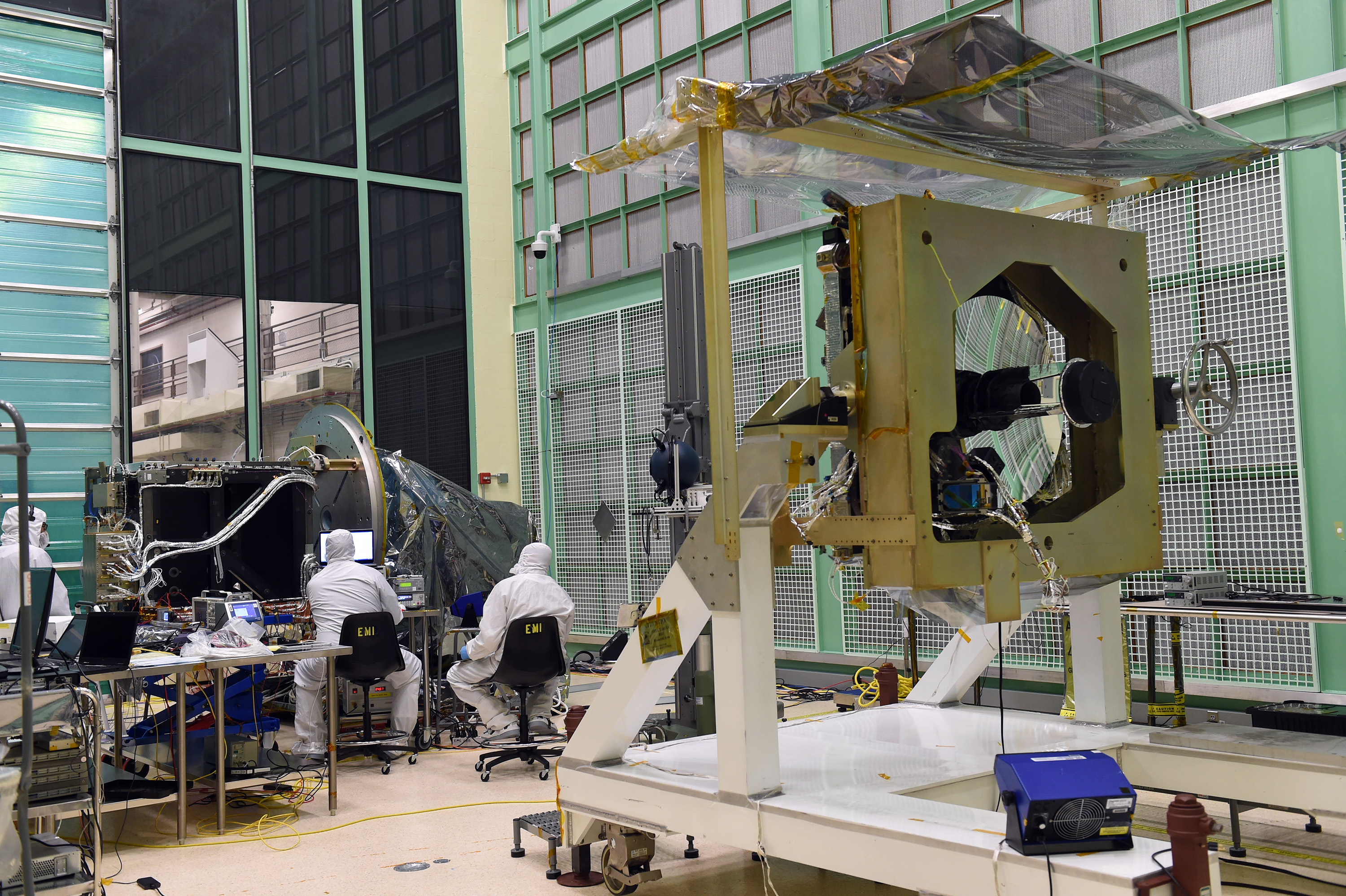
Engineers check on the box structure section of the ATLAS instrument, with the optical bench — with telescope attached — in the foreground. ATLAS is the sole instrument on the ICESat-2 satellite, and will measure the height of Earth.
The box structure of the ATLAS instrument takes shape in the cleanroom at NASA's Goddard Space Flight Center in Greenbelt, Maryland, as engineers carefully connect and attach different electrical components and fiber optics.
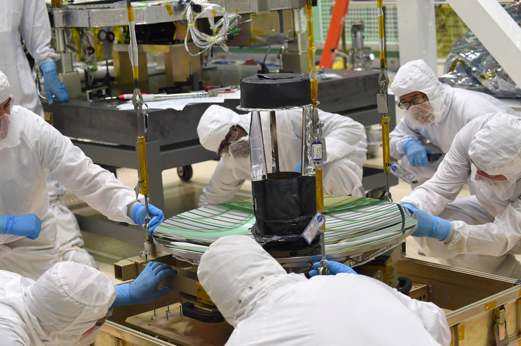
An engineer attaches components to ICESat-2's beryllium telescope, before it is attached to the satellite's ATLAS instrument.